Key Methods in Geography
Fourth Edition
Chapter 28: Environmental GIS
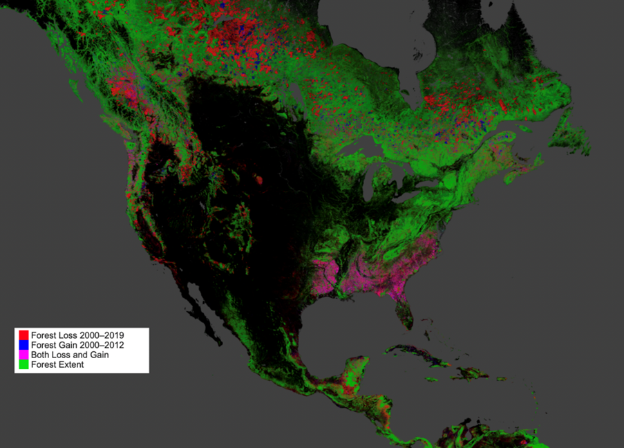
Examples of environmental GIS datasets for (a) trees > 10cm diameter at breast height in a 50ha plot on Barro Colorado, Panama; (b) tree canopy cover at the parcel level in Compton, California (https://www.fs.usda.gov/Internet/FSE_DOCUMENTS/fseprd645759.html); and (c) forest cover in North America from 2000 to 2019 (https://earthenginepartners.appspot.com/science-2013-global-forest)
a)

b)

c)
Total species richness, rare species richness and threatened species richness for birds, mammals and amphibians (data taken from Orme et al., 2005)
